


What is the challenge?
The gypsy moth is an invasive species that can devastate forest canopies. In Vermont the gypsy moth is normally kept in check by a fungus, but abnormally dry conditions prevented the fungus from thriving resulting in an explosion of gypsy moth caterpillars.
By June, the region was suffering the largest infestation in 30 years. The caterpillars devoured the leaves on trees, causing bare patches in spots that normally would be lush and green. The University of Vermont Spatial Analysis Lab just happened to be in the right place at the right time to document this phenomenon.
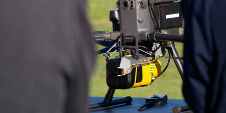
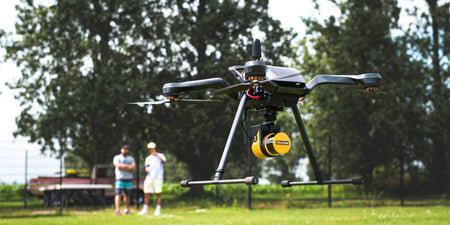
The University of Vermont team has nearly a decade of experience using drone technology, but up until this point, only employed imaging sensors on their drones. Developing an understanding of changes to the forest structure caused by the gypsy moth outbreak required active sensing, so the team turned to YellowScan’s Mapper LiDAR sensor.
What about the workflow?
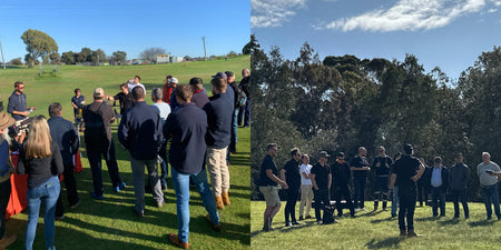
The YellowScan Mapper’s easy-to-use workflow and quick training that UVM-SAL received was critical to the mission’s success. Frontier Precision, a member of YellowScan’s Global Partner Network, arranged for an on-site training session in Vermont. This timely session and further support from YellowScan gave Adam and his team the confidence and know-how to get their drone and LiDAR solution in the air and gathering data. They collected data at the same location in July during peak defoliation and then again in August as the leaves recovered. The captured photos and point cloud data show a profile comparison of the same area of trees at the site.
Now they have a baseline of data points to compare with in the spring of 2022 when the caterpillars will return. The data is being shared with colleagues in the US Forest Service in an effort to better understand the infestation and to determine any longer-term effects on the forest from this event. The UVM-SAL Team was featured in a television news story, you can find the link here.
What about the LiDAR mission?
The YellowScan Mapper is a purely aerial LiDAR solution that is ideally flown at 70m above ground level. It is designed to fit all professional drones such as the DJI M300 and Acecore Zoe, and comes with an optional integrated camera module. YellowScan Mapper is ideal for topographic mapping projects and is particularly suited for archaeology, forestry, and post-disaster missions. The YellowScan Mapper seamlessly integrates with existing YellowScan software solutions, CloudStation and LiveStation, making it easy to remotely check data while the system is flying, and comprehensively post-process, visualise and export survey data.
- UAS: DJI Matrice 300
- Sensor: YellowScan Mapper
- Flight speed: 10 m/s
- Flight height: 70m AGL
- Trajectory correction: PPK using CORS station operated by Vermont Agency of Transportation (VTrans)
-
Outputs:
-
LAZ point cloud
- 500+ ppm2
- Approx. 45 acre (1 flight)
- Ground points classified in YellowScan CloudStation software solution
-
DEM /DSM/nDSM
- ~ 4 cm/pixel GSD
-
LAZ point cloud
Source: YellowScan