

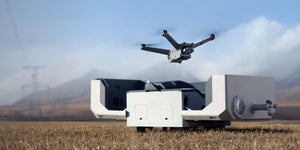


Researchers at The Australian National University (ANU) and The University of Sydney have begun to trail the use of drones to locate radio-tagged wildlife.
The drone will be used by researchers to “rapidly and accurately find tagged wildlife, gain insights into movements of some of the world’s smallest and least known species, and access areas that are otherwise inaccessible” stated Dr Saunders, Lead researcher from the ANU, School of Environment and Society.
The drone has been tested on 150 flights and have continuously demonstrated that a drone can find and map the locations of animals with radio tags. Together, the drone and connected antenna provide real-time information on radio-tracked wildlife that are mapped on a live laptop.
This method of tracking using a drone has reduced man power and therefore reduced the costs and increased the efficiency of the process. According to ANU Associate Professor Adrian Manning, this process has also reduced the time spent on tracking. Commonly, researchers would spend a minimum of half a day on tracking however with the drone it has reduced to two 20 minute bursts.
For more information on drones visit our website Sphere Communications to see our collections, and send us a message direct to our live chat with any questions!