


In the final part of our Navigator Series we shift our focus to the advanced CloudStation software and how it transforms bathymetric data into actionable insights. The Navigator is not just about capturing high-quality underwater data, it's also about providing sophisticated yet user-friendly tools for processing this data.
Underwater point correction
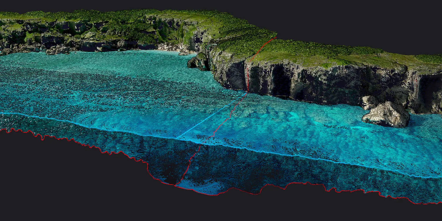
Accuracy is paramount in bathymetric mapping, and the Navigator's CloudStation software excels in refining submerged data points. The underwater point correction feature takes into account the water refraction effect, a common challenge in underwater mapping. By adjusting for this distortion, the Navigator ensures that the bathymetric data you collect is as accurate and reliable, providing a true representation of underwater topographies.
Automated water classification
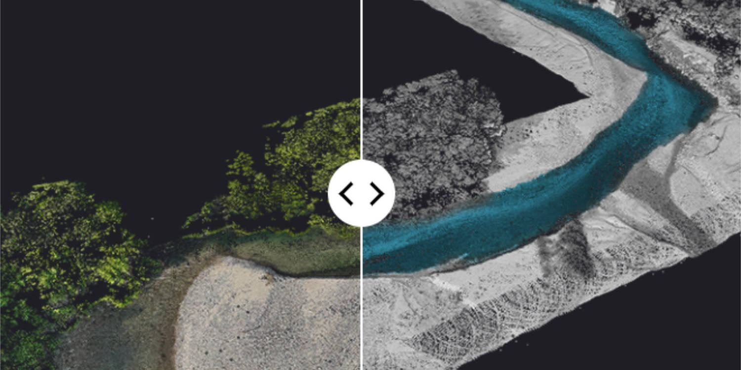
Efficiency in data processing is crucial for timely decision-making. The Navigator's CloudStation software includes an automated water classification functionality. This tool streamlines the categorisation of water bodies, distinguishing between different types of water environments automatically. This not only enhances the precision of your bathymetric mapping but also significantly reduces the time and effort required for data classification.
Automated water surface detection
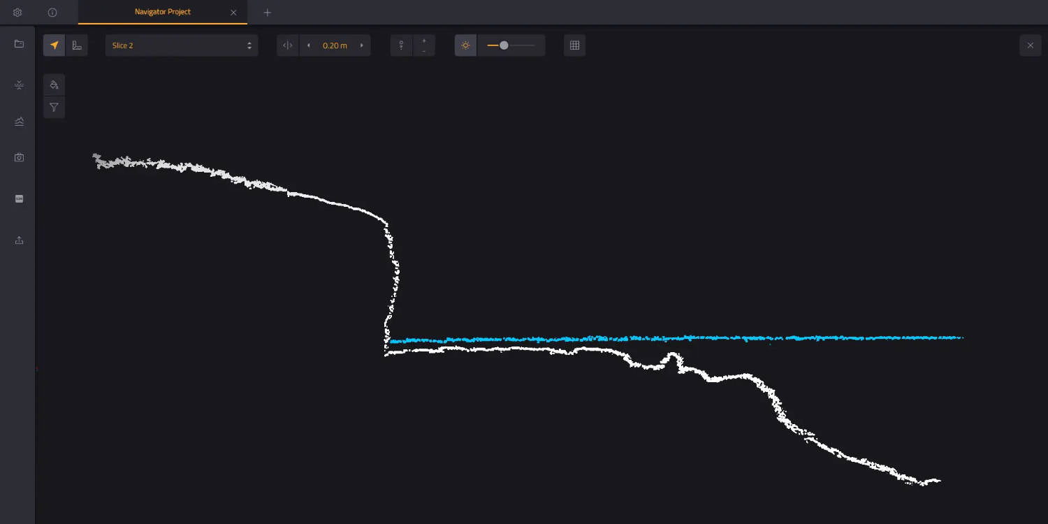
Identifying the exact boundaries of water bodies is essential for accurate mapping. The Navigator's software simplifies this process with its automated water surface detection capability. This feature efficiently identifies water boundaries, ensuring that your mapping data accurately reflects the true extent of lakes, rivers, coastlines, and other aquatic environments. By automating this process, the Navigator allows you to focus on analysis and application, rather than getting bogged down in manual data processing.
The YellowScan Navigator, coupled with its CloudStation software, represents a leap forward in bathymetric mapping technology. By automating complex data processing tasks and ensuring the accuracy of the data collected, the Navigator empowers you to undertake even the most challenging underwater mapping projects with confidence.

